Monday, April 9, 2012

Neel's Gap to Blue Mountain Shelter

Before we get to the details, a few words about Mountain Crossings.  It's a cool place, you should go there.  And I would know, we spent a Lot of time there.
Creepy Boot Tree outside Mountain Crossings.  You're supposed to throw your old boots over the branches.  They sell lots of boots here, I guess.

 The folks were nice to us, there was ample hang-out space.  Also, I bought some new boots.  I was actually fitted for new boots.  When I saw that the soles were splitting after we came off Blood Mountain I knew the old Merrel's weren't up to the task anymore.  So I padded into the store in my crocs & the least stinky hiking socks I had.  I felt a little bad subjecting the BootFittingLady to my dirty-self.  She found me a great pair of Keens and sold me some insoles (SuperFeet!) that go inside.  She also told me "oh, by the end of the hike your feet will probably be a whole size bigger"  YESSSS!  If anyone asks ever again, here is why I am hiking:  so that I can buy a pair of shoes that fit without going to the BabySection.

New Boots!

Now, onto the walking.

Top Banana's Dad and Kathleen (TBDAK) dropped me back at Neel's Gap this morning.  I walked up to the porch to sign the Thru-hiker's log and weigh my pack.  The weather report on the board was for highs in the 70's, lows in the 50's and 50% chance of afternoon thunderstorms.  I didn't sign the thru-hiker logbook after all and my pack weighed 30 pounds.  I was mortified.  One of the MountainCrossing employees was walking past at the exact moment I said to TBDAK:  "There's no way this is right, this scale must be wrong".  I'm sure he was thinking "That's what they all say".  I'm sure the scale was accurate. Ugh.

And so with new boots and a tooheavypack I headed up out of Neel's Gap.  The first 20 minutes or so my calves burned and my feet ached as I got used to the new insoles in my shoes (SuperFeet!) and I wondered if this new boot thing was a mistake.  But it got better.  I passed a few people in the morning, including the Australian couple we'd met the day before at Blood Mountain.  When I saw them, they were headed towards me.  "When was the last time you saw a white blaze?" they asked.  "Uhhhh...."  What?  I hate it when this happens.  "We walked down that hill and came to a blue blaze without any other white blazes, we looked around but couldn't figure out where the trail goes..."  I pulled out my map and we decided that we were somewhere..right...about...where all these curvy lines are... After a minute or so of speculation and "AWOL is usually so spot on.." I turned around and saw a white blaze on the tree behind me.  Satisfied we packed up and I headed out first.  At the bottom of the hill I came to a blue blaze straight in front of me and a side trail to my left with no blaze.  There was the faintest ghost of what could have been a white blaze, or a patch of lichen on a tree about 15 feet ahead.  Using this evidence, coupled with the experience I had with the trail at this point--that it usually goes up--I kept moving forward.  It was the right way, of course.  I never saw the Australians again.


I passed CowRock Mountain and moved to the "other side of the map". 
Fritzi "Steak" at Cowrock
At the bottom of Cowrock mountain I came to my first Trail Magic--a guy named King Tut had set up a tent at the road crossing there (Tesnatee Gap).  I had a coke and some Cheetos and only minimal proselytizing.  The sky was getting dark and I was worried about being caught on a ridge in a thunderstorm.  I headed out (or straight up) of Tesnatee Gap.  I crossed Hogpen Gap and saw some more trail magic but left it behind.


Striking a pose, there's nothing to it.

Had a quick walk over a ridge for a while--trying to outrun the storm that I could hear behind me.  After a few hours I pulled into Low Gap Shelter where I had some cheese and crackers with the folks there.  I met Roadside, Candace, Swinging Jane, Stats, a few other folks whose names I can't remember and Preacher-man.  About 4 I decided to move on.  On the way to Blue Mountain Shelter I passed the couple we'd been leap-frogging with and the other folks we'd camped with at Jarrad Gap.  I was tired and my pack was heavy but it was only 5 and I didn't feel like stopping so I moved on.  About 5:30 I had a break on a rock and Preacher-man caught up with me.  He sat down to have a cigaratte.  He was carrying a gallon jug of water, a 30 year old pack and was wearing jeans.  Not exactly typical hiker garb.  "I wish she would just wire me money so I didn't have to wait for a package".  I started stuffing food in my mouth so I couldn't possibly participate in this conversation.  "I mean, really, she should go to Walmart and get me a debit card so I can just buy what I want".  I don't know who She is, I didn't ask.  I got a bit creeped out, sitting there with my nice-gear and full food bag with a buy bemoaning his lack of money.  "I'm getting cold, see you"  and I took off.  Walking even faster now to keep the storm and creepy-man behind me.

After I left Creepy-man behind I still had 4 more miles to Blue Mountain Shelter.  I was already tired and was after 5 o'clock quittin' time, but I had my heart set on the shelter and I still had plenty of daylight.  Then I met these rocks.

Miles and miles of these horrible rocks (ok, it was like 1 mile of rocks).  


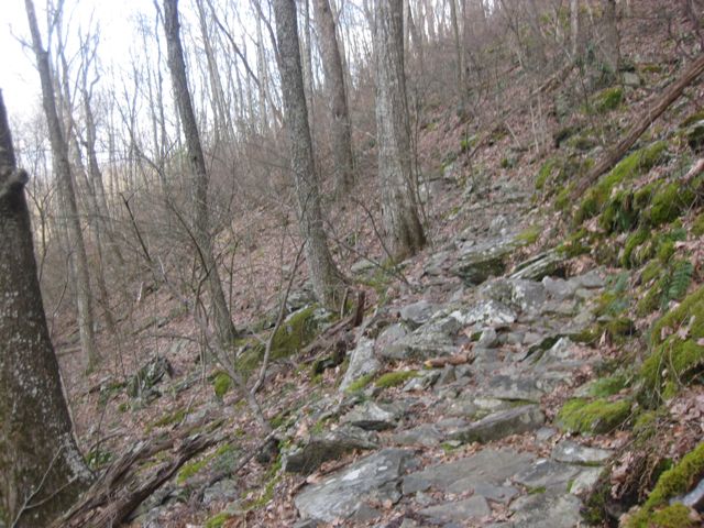
They were much worse in person.

I rolled into Blue Mountain Shelter around 7:30pm.  There was a group of folks there that recognized me.  "Hey, you're the Girl Scout.  Where's the kids?"  I told them that the kids had to go home because, you know, School.  

"We heard you got all your food stolen last night". 

 "No, that was everyone else, my scouts are professionals."  
 

I made dinner and sat and waited a while for my alcohol to burn out (because I put waaaay too much in my stove, I hoped no one noticed).  Inside the shelter they were trying to decide whether or not they would get Hanta virus from the dust in the corners.  Conversation turned to Creepy-man.  I happily intruded on their conversation to inform them that I'd passed him and relayed that he was planning to make camp a few miles before the shelter.  There was a collective sigh of relief and I was glad that I could bring good news.

I set up my tent just outside the shelter and hung out for a bit listening to the Best Friends Club talk about all their plans for the future together.  The way they joked with eachother and leaned in shoulder to shoulder over the topo discussing elevation and mail drops I was certain that they were friends from Before the Trail.  "So, how do you all know eachother?"  The girl who was making a pair of flip flops out of 6 inches of ratty string and a couple strips of duct tape looked up "Oh, we met up at Hawk Mountain".   I guess the trail gives some folks enough common ground to form immediate families, but they were a few days ahead of me--I just lost my trail family.  I knew that over the next couple days I'd figure out who would be in my crew.  It depends on who you keep pace with and who isn't too creepy.

I hung my food and went to bed.  Had a nice phone message from one of my Scouties wishing me good luck.

Monday, April 2, 2012

March 15, 2012 Jarrard Gap -- Hobbit Hole

Woke up this morning to news that everyone else camped at Jarrard Gap had their food stolen overnight by bears.  Not us.  Our food was up the hill 200 feet away, still hanging where we left it.  The bear had pushed over the tree that had everyone's food on it.  I thought I heard something last night.  A guy tried to scare the bear off by lighting some white gas.  He said it did scare the bear, but only for a few minutes.  !! What?  Ok, so we shared some hot cocoa and oatmeal with them this morning.  Top Banana tried to off load her jar of peanut butter on them but someone else beat her to the punch!

Hike to the top of Blood Mountain was not hard.  There were switchbacks but the grade was moderate.  Top of Blood Mountain was awesome--great views--and a fun rock to climb on.  The Blood Mountain cabin was old and spooky.  Then we hiked down the mountain.  Holy Giant Rocks Batman!  The North Side of Blood Mountain does Not mess around.  Serious business.  You've been warned.

We reached Neel's Gap around 1pm.  Top Banana's Dad + Kathleen arrived and LoneRanger, Prof.Oak and Top Banana took off with Dad to get the cars from Amicalola.  Kathleen + I + the Scouties stayed and entertained ourselves for a few hours.  (It took a while for them to get back because: Funeral Procession!)  I bought some new boots (1 year in the Alps, 3 years in Florida and one trip down Blood Mountain is the lifespan of a pair of Merrels, I guess), AquaMira, a new spork (my other one succumed to the night of horrible conditions on Hawk Mountain) and alcohol for my stove.  That's right, I'm switching to: chemical water treatment and a practically weightless stove-setup. 

Back at the Hobbit Hole we had a wonderful (!!!) dinner of cheeseburgers and salad.  We recapped the highlights and lowlights of the trip.  General consensus:  Highlights--everything. Lowlights--walking uphill and rain at Hawk Mountain. 

I resupplied and resorted my gear with the help of a few of the Scouts.  Mostly they jumped around and I told them to Not Touch My Food!  (which is mainly Snickers bars.  They are tempting).

The girls took showers and went to bed around 11.  We are going in different directions in the morning.


Saturday, March 31, 2012

March 14, 2012 Gooch Mountain Shelter to Jarrard Gap

Long day.  Started from Gooch Mtn Shelter around 9:20.  Shuffled down the trail for a while until we came to a stream.  Spent 45 minutes filling everyone's water bottles and bladders.  From there the groups split up again and headed for Woody Gap.  Nothing too memorable about the terrain between Gooch Mountain and Woody Gap--there were some nice springs that we stopped at and we walked up some hills and down some hills. 

Woody Gap was really nice though, a beautiful view and some picnic tables.  There was a road to cross. Told the kids not to get run over (that would be hard to explain) and met a ridge runner who was concerned about whether or not we had blisters. We have none.

The climb out of Woody Gap to the top of Big Cedar was very challenging. Switchbacks!  Hand-over-hand scrambles!  Steep!  But, we made it to the top. 

We all met up on top of Big Cedar and decided to find a place to camp around Burnett Field Mountain, rather than pushing on to Jarrard Gap.  I took off with the faster group to look for a place to camp. When we got to Burnett Field Mtn there wasn't much of a field.  The topo showed some flat ground there, and there was, but no one had camped there in a while and it would have been more work to find a campsite than to just press on the extra mile-and-some to Jarrard Gap. 

Lots of other folks at Jarrard gap--which is a flat area with lots of tenting area right before the beginning of the Blood Mountain climb.  We're camped here with lots of folks we've been keeping up with since Hawk Mtn.  A couple asked for assistance with their MSR stove.  Bert was pleased to show them how to light their stove.  ( A proud moment, go Girl Scouts!).


Feels good to be out on the trail, hard to believe this is our last night.

Getting water.

Getting more water.

Yup, still getting water.

This is a tree.

This is where water comes from.

Lunch break at Woody Gap.


Photo ops at the Woody Gap sign.

Big Cedar belongs to us.


Getting some water.


Dinner at Jarrard Gap.


Tenting at Jarrard Gap. You know, in the middle of the trail (shhhhh).

Wednesday, March 28, 2012

In other news: Africa?

Why I'm hoping this Africa thing works out:

Because, who wouldn't want to spend time with these kids?  They enjoy school.  They come to school early to help clean, because they Love school. And finally, they sing every morning!

March 13, 2012 Hawk Mountain to Gooch Gap

Everything is drying out.  We had a rainy breakfast but the fog lifted and the sun came out.  We hit the trail around 9:30 and walked the shoulder of a mountain and had a nice view of the valley and mountains for the first time.  Had a few climbs:  Sassafrass Mtn and Justis were both challenging, but spirits were high and the miles went by quickly.  We blew down the north side of Ol' Sassy and jumped over Cooper Gap and owned Justis.  We dried out gear and tents in the sun on top of Justis, but folks were out of water and some crankiness was beginning to seep into the mix.  From the elevation profile (We're using the ATC maps) it looked like we needed to climb Phylis Mtn next, on the way down to Justis Creek.  However, we had a nice surprise--the trail was a gentle meandering grade down to the creek.  No climb!  

Justis Creek really is a marvel.  It's wide and shady.  The girls took off their shoes and played in the creek for a long time.  They found a 'tiny lobster' (crawdad) and saw salamanders and tried to catch some water-striders with no luck.  Water bottles were filled, morale soared once again.

Out of Justis Creek we hiked up a short grade (1/2 mile) and then it was flat the rest of the way to the Gooch Gap Shelter.  This place is packed full.  The shelter is on a hill and there are very few flat tent sites.  We're all on a slope just below the shelter.  We can hear all the shelter-goings-on.  Tall tales!  Bad choices! Swear words! 

We had our GadoGado Ramen for dinner.  The girls give it an enthusiastic Thumbs Up!  "Thbhitthhh itthhhh gohhwhhhoodd"  says Mo with her mouth full.   

Pictures!  (I thought I had pictures of Justis Creek, but I don't.  Maybe they're on the Other Camera?)

Our mudpuddle camp at Hawk Mountain


 The sun comes out!

Packing wet tents :(


Hill camp at Gooch Gap

Making Dinner

Stove Master

Feeding frenzy

You know, hangin' out.

Teeth Brushing!

 
And finally, Bert's shoulder catches on fire. Alarming!


Tuesday, March 27, 2012

March 12 2012. Black Gap Shelter to Hawk Mountain Shelter

Girl Scout's 100th Birthday.  The Operator's 13th Birthday.


We didn't get up until 8am and didn't manage to get out of camp until half past 10.  We were fogged in and we all took a fair bit of time to organize ourselves.  We made Springer Mountain around 11:15.  Took lots of foggy pictures and headed downhill to the FS42 parking lot where we would meet Top Banana's dad to pick up supplies for the remaining 4 days.

We picked up resupply and celebrated Girl Scouts' and The Operator's birthdays with cupcakes.  I love a good birthday...  It's been difficult going for some of the girls and the break at the parking lot boosted spirits a bit, as well as the promise of some flat ground ahead.  The Approach trail certainly was a cruel shock for us.

It was foggy but manageable all day until around 4pm.  Mo was puking again and Bert was attending to her feet when it started raining.  Sprinkling, not raining too hard for full-on rain gear but promising to start pouring soon.  The Rogues (what we're calling the faster group of hikers) made Hawk Mountain around 5:30 and started setting up tents.  There is lots of flat space around the shelter, but there are also lots of people tenting here.  We managed to locate a spot with only a small puddle where half of our tents could fit comfortably but all of our tents could fit uncomfortably.  The Sweepers arrived around 6:00.  The rain started coming down harder and instead of our usual cooperative dinner making I just took the reigns, lit the stove and put Bert in charge of the rest.  It poured all through dinner.  Everyone was starving and hovering around the stove.  The stove was in the middle of a mud puddle.  This was a distinct low point in my camping-life.  Crankyness abounded.  Rain poured.  The puddle in the middle of our site grew and tents were relocated amid groans and whines.  Water dripped off the bill of my rain coat into the Mac and Cheese--usually a favorite camp meal but this night it tasted more like sawdust.  Muddy sawdust.  We couldn't keep the mud out of the food and we didn't care.  The girls went straight to bed after eating.  There was minimal giggling.

All of my gear is wet.  Everything is wet.


Breakfast at Black Gap

The log at the top of Springer


Signing the Springer Log


The Eaglet Express on top of Springer on the 100th Anniversary of Girl Scouting

The Operator's birthday cupcake


Only picture taken at Hawk Mountain.  Mo looking properly miserable.